Investigation of Residential Flooding
Background: Earth Forensics was hired by counsel on behalf of the insurance company to investigate residential flooding that occurred during storms in December 2010 and January 2011, in Escondido, CA. Several homes were flooded and upgradient properties were sued for changes made to their properties that may have increased downgradient surface water flows.
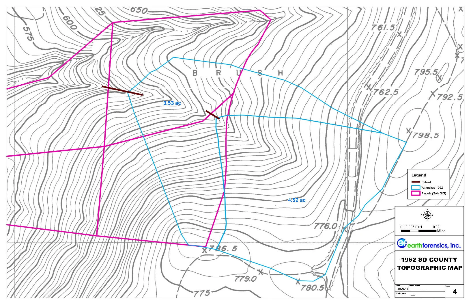
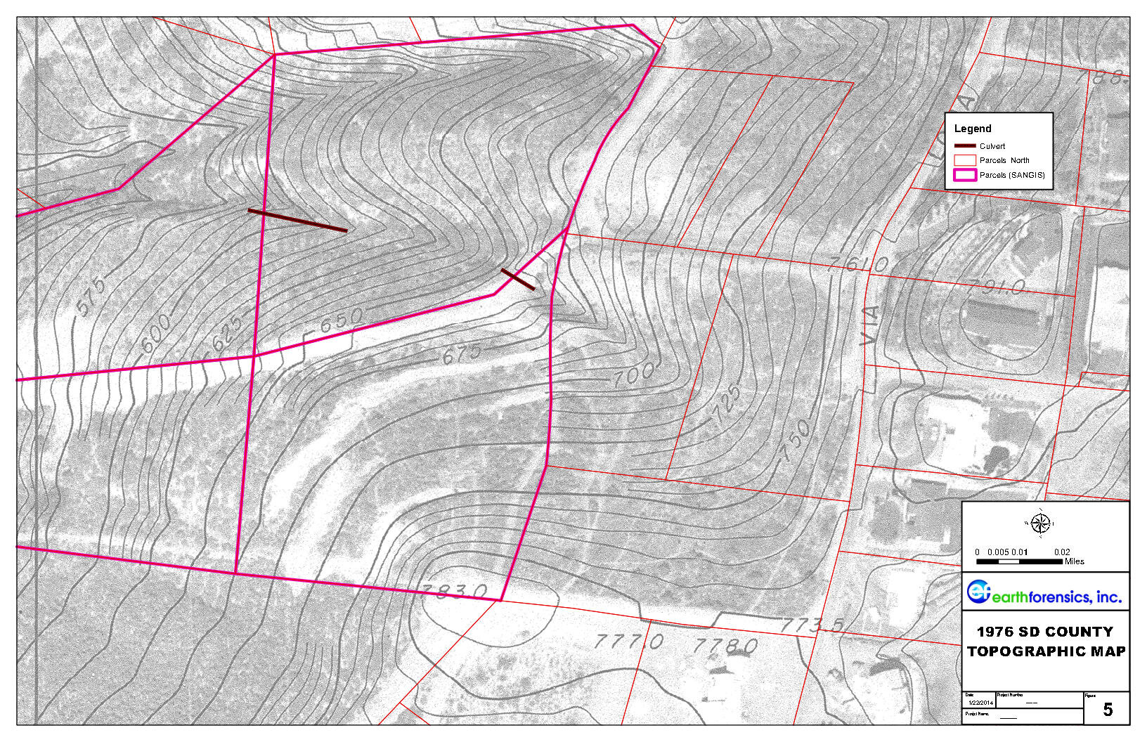
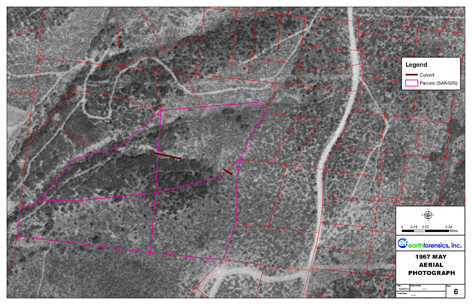
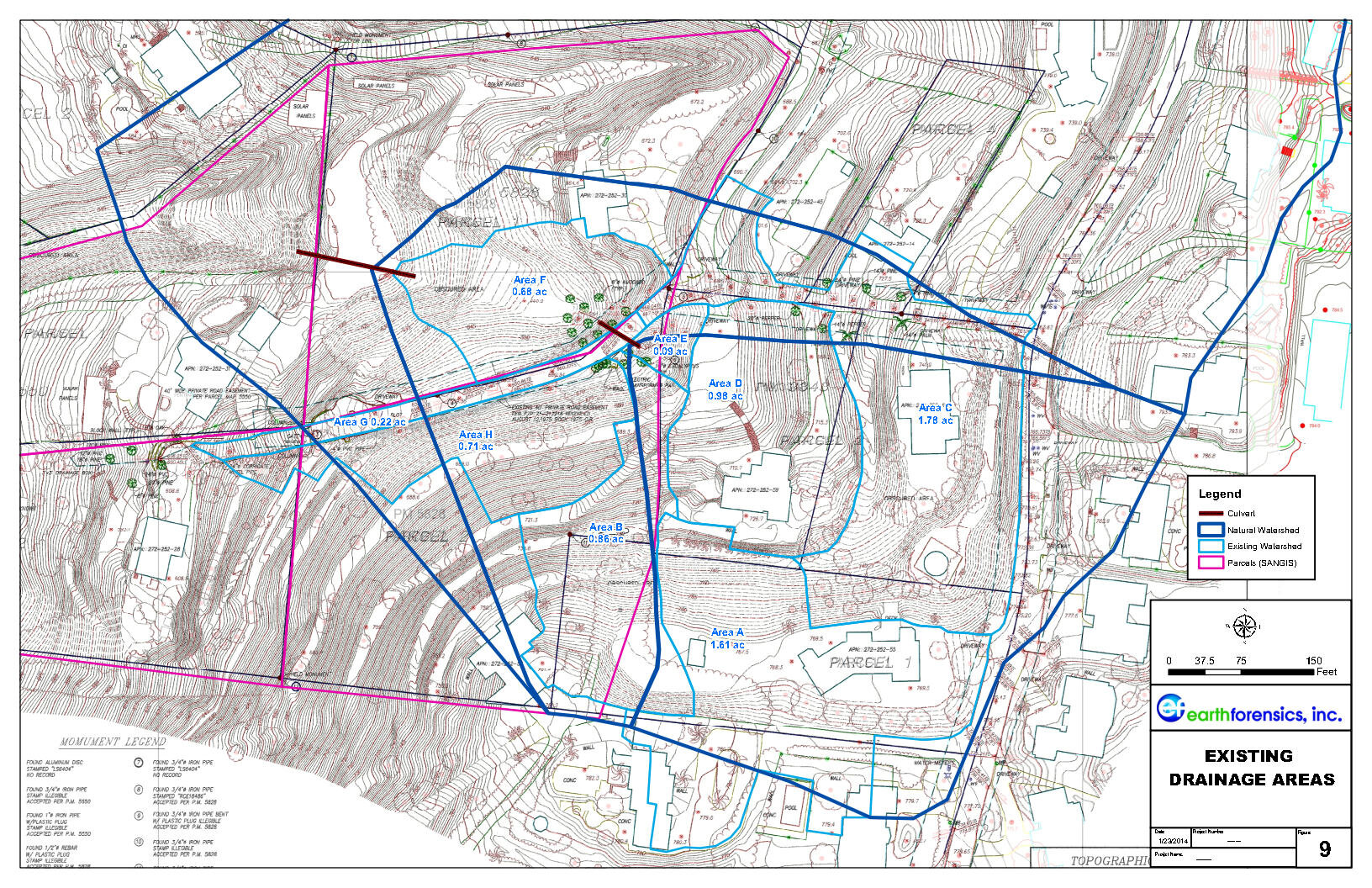
The Study: Earth Forensics scope of work included analyzing historical aerials & topography, rainfall analysis and RADAR in order to investigate the flooding event. Our team also investigated the watershed and historical watershed diversions that were potential causes.
The Results: After the study was completed, homeowners impacted by the storms settled their case out of court.
(click on the image to expand)


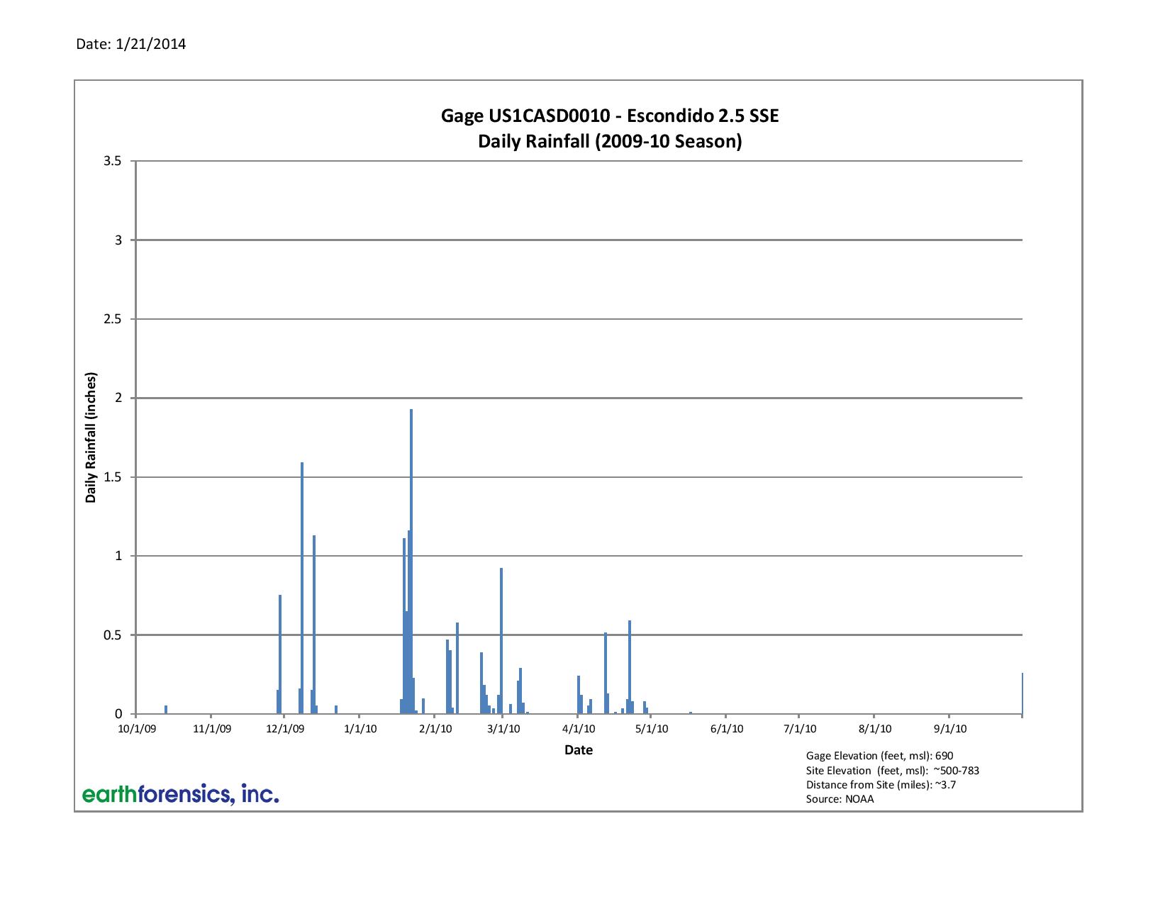
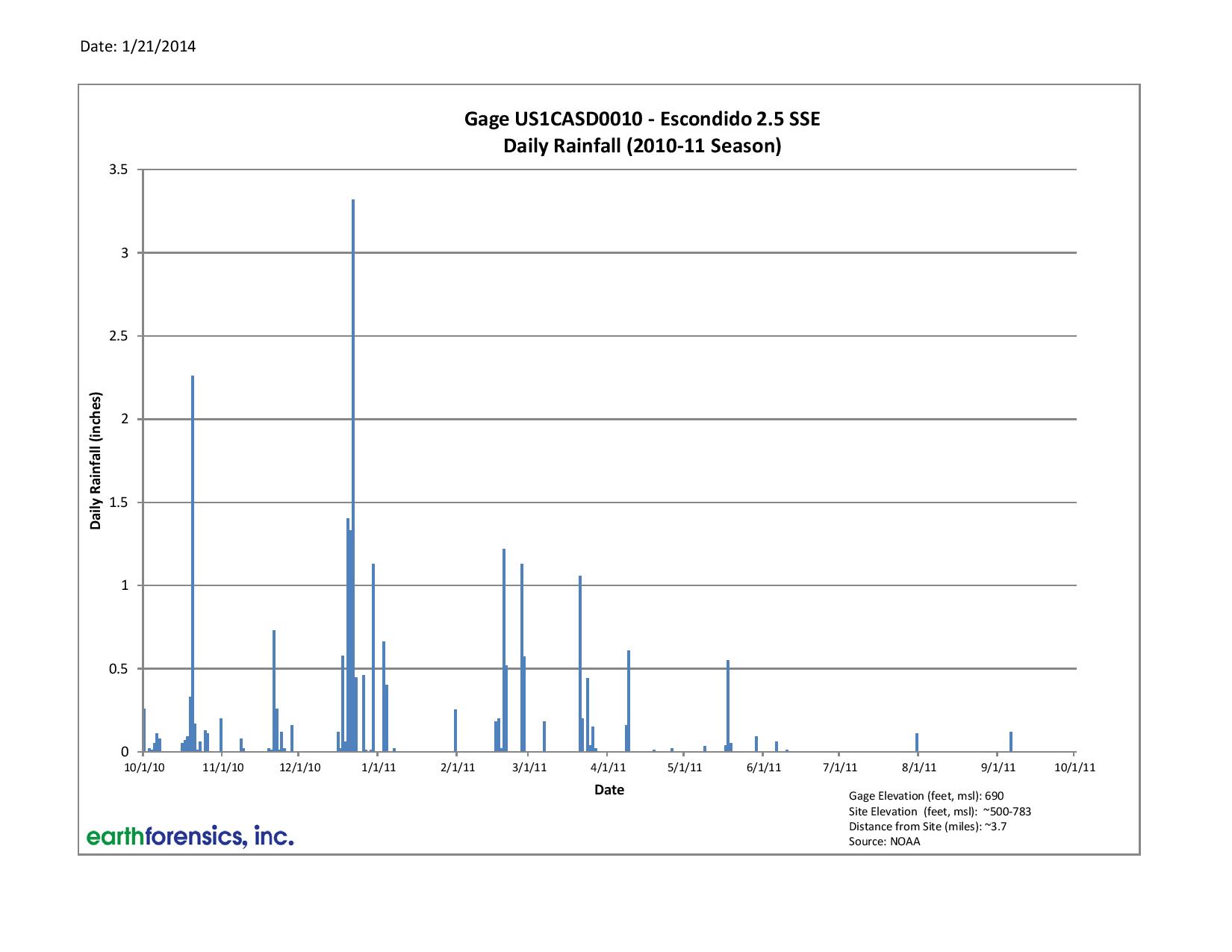


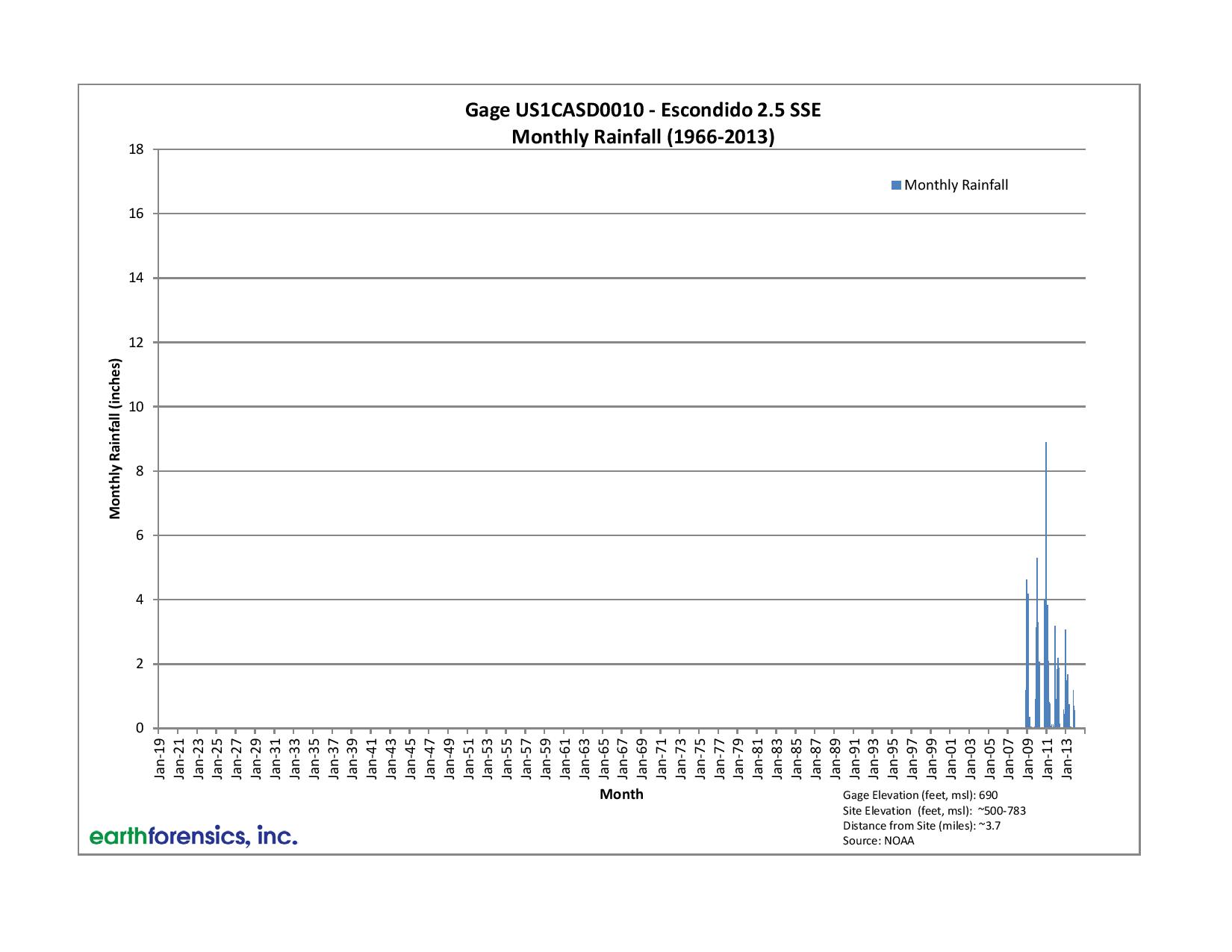

For Flooding Investigations, Earth Forensics gathers hydrometeorologic data and performs statistical analysis in order to decipher causation of flooding events throughout the United States.
Flood Investigations include:
• Hydrometeorologic services
• Historical aerial photography/satellite imagery interpretation
• Record, literature and air photograph research
• 3D modeling of flood plain/event
• Flood hazard mapping
• Estimating potential flood losses using FEMA HAZUS MH
• Drone photography
• Dam inundation mapping
• Litigation support
For more information on how our team can help you, please contact us at:
Phone: 714.296.4055
Email: contact@earthforensics.com